
Wilderness Park Needs Your Voice
Dearest Supporter of Wilderness Park,
Friends of Wilderness Park is reaching out to all our supporters to ask them to consider sending a message to the Lincoln City Council and Mayor opposing the change of zone for the property west of Wilderness Park southeast of 1st and Pioneers.
The planning department’s staff report can be found at the link below.
https://app.lincoln.ne.gov/city/plan/boards/pc/staffreports/2022/033022/AN21013%20CZ21057%20staff%20report.pdf
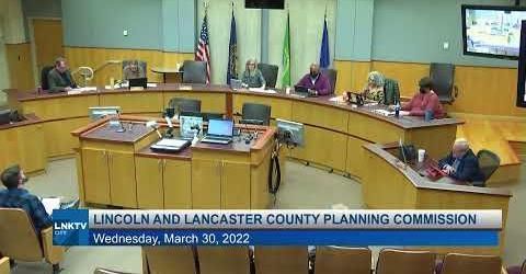
The planning commission’s hearing on the zone change can be seen on YouTube at the link below. Staff Comments are from 0:10:00 to 1:03:31 and 2:59:07 to 3:43:43.
https://www.youtube.com/watch?v=B5UMBaa-xhg
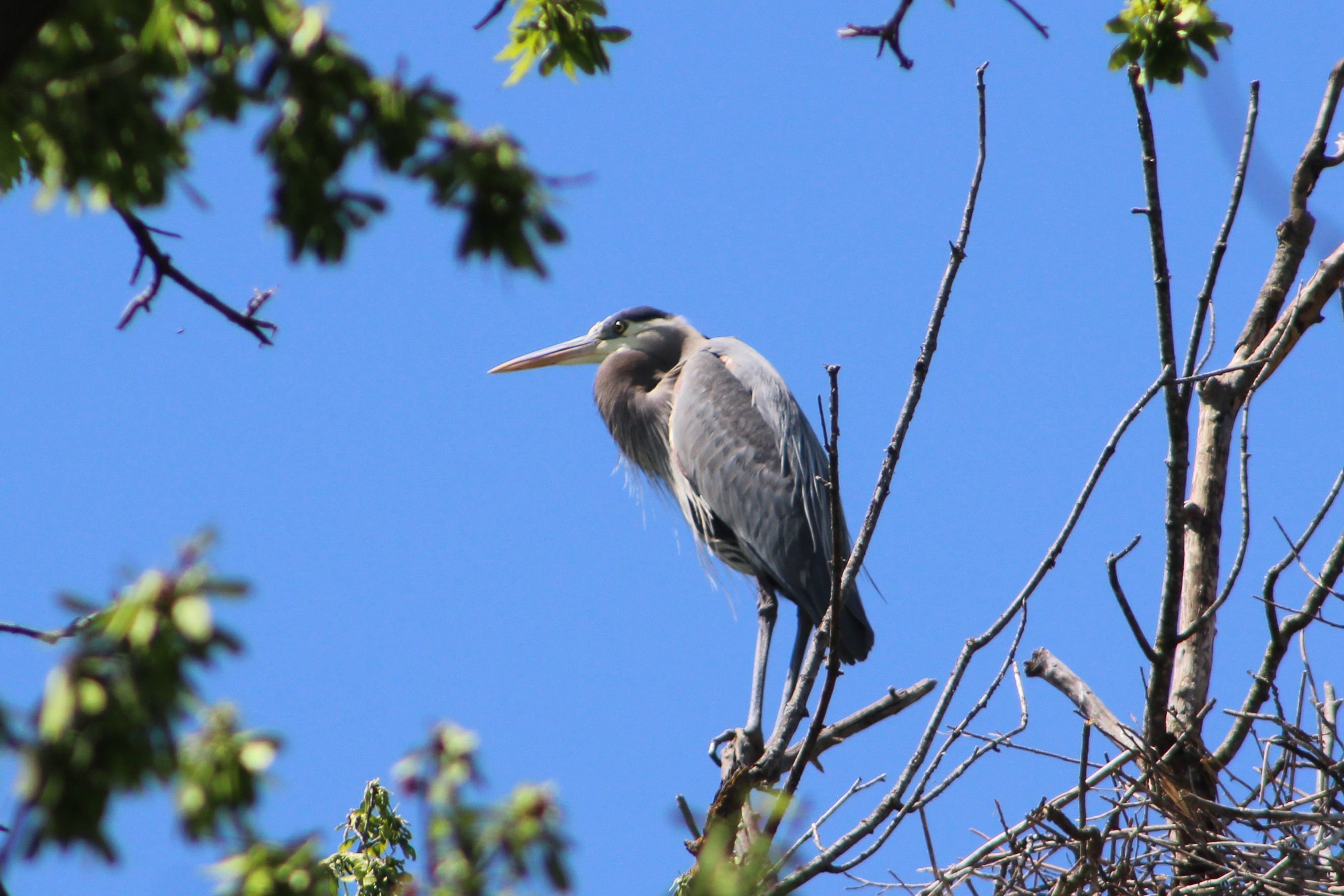
This land will share a property line with a rare sandstone prairie not found anywhere else in Wilderness Park or Lincoln’s park system and the proposed zone change would threaten the health of the flora in this area.
After a brief call from the developer last October, Friends of Wilderness Park has been in direct contact with the developer and planning department since early March expressing our concerns with the development’s proximity to the sandstone prairie, stormwater management, light pollution, and grading.
Unfortunately, most of these concerns with protecting the community downstream and ensuring the ecological health of Wilderness Park were not given enough heed in the staff reports of the planning commission, the developers Planned Unit Development (PUD), or the amended motion approved by the planning commission.
The fact that two planning commissioners voted against the zone change with sizable public opposition shows why now is the time to ask City Council to delay their vote on zone change #CZ21057 until more research can be done on how to wisely develop the city while respecting the irreplaceable asset which is the Salt Valley Greenway. A strong Wilderness Park Environs Study would achieve this goal. Friends of Wilderness Park is prepared to help with funds to complete this study.
Other reasons to delay the vote until more data can be collected is as follows.
The future of the Highway 77 and Pioneers Boulevard intersection has not been decided by the Nebraska Department of Transportation. This will heavily impact traffic and development in the area especially since Old Cheney to the south will be closed. A sufficient traffic study with the possible impacts of this intersection’s future has not been made.
The comprehensive plan’s policies of Conservation Design, Native Prairie, Ecology and Habitat, Floodplains and Riparian Areas, Green Corridors, Environmental Resource Protection, Open Space and Development, and Watershed Planning are not addressed in the planning department’s staff report or sufficiently addressed during the planning commission’s hearing. These policies must be addressed sufficiently before a vote is made and a Wilderness Park Environs Study would provide the data needed to move forward. The action steps for these policies from the comprehensive plan can be found at the bottom of this document.
The PUD does not provide any information regarding grading, drainage, and stormwater detention. In fact, these requirements are shockingly waived in the zone change proposal. Being so close to Salt Creek and the floodplain, the public must be able to view these plans in a transparent manner. Those who live downstream are at risk when a 100-500 year flood occurs and these residents must be able to give input to mitigate property damage.
This zone change request appears to have been created through a business-as-usual process. The fact that the goals mainly mentioned in the staff reports sight goals that would be attractive for development far away from the Salt Valley Greenway but give no heed to the sensitivity needed when building near a floodplain or biologically diverse area does lead us to believe this zone change request was written without due diligence or a full understanding of the surrounding area.
The Wilderness Park Sub Area Plan is a 22+ year old plan and much has changed it those 22 years. We now understand the necessity to plan with extreme discretion in a floodplain and to mitigate climate change.
One item that needs to be clarified is if trails funded by the National Parks Service need to be refunded if a development damages the trails. Wilderness Park’s trail system is a part of the National Trails System.
The City of Lincoln Transportation and Utilities Department is working with FEMA for approval of their mapping schedule through FEMA’s Cooperating Technical Partnership program. The schedule laid out begins in the 4th quarter of 2022.
Below are city documents supporting a Wilderness Park Environs Study.
The Salt Creek Resiliency Study cites:
1. The existing conditions hydrologic models do not use up-to-date precipitation frequency
estimates.
2. The existing conditions flood hazard data on Salt Creek underestimates the updated
conditions flood hazards.
3. In the “business-as-usual” global greenhouse gas emissions scenario, precipitation events
causing flooding are forecasted to increase by nearly 10 percent by the year 2100 in the
Salt Creek watershed.
4. In the “business-as-usual” global greenhouse gas emissions scenario, flood hazards will
increase significantly in magnitude in the Salt Creek watershed by the year 2100,
compared to existing conditions flood hazards.
5. There is a high degree of uncertainty in future conditions flood hazard analysis. When
planning for future resiliency, it is critical to account for this uncertainty.
The City of Lincoln Climate Action Plan has many initiatives which cite improving protections for and with Lincoln residents, maximizing natural climate solutions and engaging residents in co-creating a climate smart future.
Initiatives include:
1. Continue to encourage installation of green infrastructure strategies where appropriate, to include grants and incentives. Examples of green infrastructure strategies include rain gardens, bioswales, and permeable pavement to reduce stormwater runoff. Expand guidance/resources, incentives, and implementation.
2. Continue working with Lower Platte South Natural Resources District to identify and implement flood risk mitigation strategies.
3. Review and assess increasing minimum stream corridor requirements along creeks and rivers providing additional flood damage prevention, preserving riparian/other critical habitat, and contributing to improved water quality
4. Develop updated modeling of stormwater runoff based on updated precipitation data (NOAA Atlas 14) and engage in a public discussion of proper management on the basis of updated models.
5. Invite impacted stakeholders to serve on a Drainage Criteria/Salt Creek Resiliency working group to review and assess the recommendations prior to implementation.
6. Conduct a benefit/cost analysis of implementing structural measures to address stormwater runoff modeled upon updated precipitation data (NOAA Atlas 14).
7. As floodplain maps are updated, identify specific vulnerabilities related to Salt Creek levees and include prevention, protection, mitigation, response and recovery strategies in the Lancaster County Local Emergency Operations Plan (LEOP), the county’s Hazard Mitigation Plan, and the Lower Platte South’s Hazard Mitigation Plan.
8. Continue and enhance current outreach and education efforts with landowners and business owners located in the revised floodplain about their flood risk. Develop a comprehensive outreach and education strategy with residents in the revised floodplain about their flood risk.
9. Re-charter the Mayor’s Environmental Task Force to align with the Climate Action Plan Vision.
10. Continue to support prairie restoration and protection of natural resources.
11. Continue to support the Lincoln Parks Foundation and Parks and Recreation Department Land Trust initiative, working in partnership with landowners to preserve native prairie, wetland areas, and other natural resources.
12. In response to the findings of the Salt Creek Resiliency Study, assemble key partners and leaders in the City and County to develop comprehensive strategies that reduce flooding risks, improve soil health, sequester carbon, and maintain natural systems within the City and County, to include the Parks Foundation Land Trust initiative.
Action steps from the comprehensive plan relating to Wilderness Park and Salt Creek Watershed:
Conservation Design
1. Encourage conservation design principles as part of the development process. Developments that
incorporate conservation design principles should be eligible for greater densities, height, lot, and
area adjustments. Examples of conservation design best practices include:
a. Development setbacks beyond the minimum floodplain corridor in order to help preserve riparian habitat.
b. Land area within new developments that is designated specifically for trees and/or prairie.
c. Sustainable landscape design that includes native and drought-tolerant plantings, limited use of turf grass, rain gardens, bioswales, infiltration beds, and constructed wetlands.
d. Cluster subdivision design that protects flood-prone areas by grouping new development in
less-sensitive areas within a subdivision while maintaining a high overall building density.
e. Dedication of a portion or all of a building’s roof space as a green roof.
f. Minimizing disturbance of the natural topography on a development site.
2. Incorporate conservation design principles into public projects and development projects utilizing public funds (such as TIF) as appropriate.
3. Incorporate conservation design into new subdivisions with the initial steps of completing an inventory of existing and future land uses, natural resource evaluation, and a build out map. Utilize goals of the Lincoln Climate Plan as a guide for developing conservation design recommendations.
4. Promote development of conservation design standards of new subdivisions that maximize open space conservation and interconnected network of such open spaces while being sensitive to overall building density.
5. Develop project approaches which view stormwater as an asset, by working with the natural topography and using wetlands, floodplains, and natural drainage corridors as natural ways to manage flood flows and stormwater runoff.
Native Prairie
1. Develop planning guidelines, management techniques and supporting policies for preserving native prairies and grassland. Include carbon sequestration measurements in all cost-benefit and environmental impact studies.
2. Coordinate prescribed burn plans among public agencies and review impacts on new urban areas when evaluating development proposals.
3. Identify opportunities to work with property owners, both public and private, to acquire land or conservation easements that can serve as buffer areas around prairies and other natural areas for management and resource protection as well as support use of federal, state, or local conservation programs.
4. Investigate means for encouraging native prairie restoration by private and public entities.
5. Utilize the University of Nebraska Center for Grassland Studies in assessing alternatives for grassland
preservation and restoration. For signature landscapes, utilize the Greenpoint Challenge of 2001 and the
UNL Nine Mile Prairie Environs Master Plan of 2020 as guiding documents. Resurvey and update the
County’s prairie and grassland inventory for inclusion in the Natural Resources Geographic Information Systems (NRGIS).
6. Resurvey and update the County’s prairie and grassland inventory for inclusion in the Natural Resources Geographic Information Systems (NRGIS).
7. Include prairie owners and managers in review of any Growth Tier Changes that may directly impact a designated prairie.
8. Expand native prairie plantings through strategies such as requiring the addition of native prairie plantings to detention ponds and runoff areas, as well as residential or commercial development. Continue to support or expand the Prairie in the Parks program.
9. Continue to support the Lincoln Parks Foundation and Parks and Recreation Department Land Trust initiative, working in partnership with landowners to preserve native prairie, wetland areas, and other natural resources.
10. Create a Carbon Sequestration Plan. This plan would involve an analysis of Lincoln's tree canopy, parks and greenways, open lands, composting activity, open water areas, impervious surfaces, grasslands, and native prairie.
11. Work with homeowner associations, partner organizations, and agencies to increase use of native plants and prairie in landscaping.
12. Educate citizens, increasing their appreciation for the aesthetics of native plantings and raising awareness of the benefits of increasing such plantings that would foster pollinator habitat, sensible water use, flood control, and carbon sequestration.
13. Lincoln is committed to the Mayors’ Monarch Pledge, which is a program through the National Wildlife Federation. As such, Lincoln is committed to the preservation of precious ecosystems and native habitats that protect the monarch butterfly and other pollinators
Ecology and Habitat
1. Research continues into the conservation of Nebraska’s eastern saline wetlands, which will enhance Salt Creek tiger beetle habitat. This will continue to include authorizing or soliciting funding for hydrology or hydrogeology research of the habitat area, determining basin-wide impacts of land use and human activities on the wetlands, characterizing the tiger beetle’s biology and habitat, and assessing the economic impacts of potential management efforts.
2. Continue cooperation between public and private entities to protect habitat for threatened and endangered species. Current efforts include those of the Saline Wetlands Conservation Partnership, the USDA Natural Resource Conservation Service, the Nature Conservancy, Nebraska Audubon, and others.
3. Landowners with saline wetlands and within the 500-foot buffer zones should be offered assistance concerning programs to preserve and protect wetlands and transition lands occurring on private property.
4. Continue to investigate incentives allowing land owners to pursue voluntary purchases, conservation easements, transfer of development right (TDR) or other similar preservation options.
5. Continue to explore grant opportunities for saline wetland preservation and enhancement.
6. Continue the public education effort to raise awareness of the Salt Creek tiger beetle and its unique habitat.
7. Review and revise regulations as appropriate for requiring buffer areas around critical natural areas.
8. Continue support of native plantings, creation of community gardens, expansion of pollinator habitat by the Parks and Recreation Department.
9. Create a Carbon Sequestration Plan. This plan would involve an analysis of Lincoln's tree canopy, parks and greenways, open lands, composting activity, open water areas, impervious surfaces, grasslands, and native prairie.
Floodplains and Riparian Areas
1. Designate areas for future urban development outside of the floodplain and floodway to reduce flood risks and to preserve or create floodplain areas.
2. Develop and utilize watershed plans during the review and evaluation of proposed developments and as a guide in the preparation of future capital improvement projects.
3. Utilize stormwater as an asset, by directing it through natural waterways, wetlands, and drainage corridors to minimize flood damage and prevent Non-Point Source Pollution (NPS) from occurring when storm waters flow through impervious surfaces in urban areas and cultivated and grazing land in rural areas.
4. Implement a Rain to Recreation watershed approach that reduces storm water damage, aids in maintaining water quality and provides additional natural areas that can be used by the public for recreation and educational purposes.
5. Continue to expand and enhance the following stormwater run-off mitigation measures including:
a. Vegetative buffers along stream corridors.
b. Preservation of natural areas, actively preserving the natural functions of floodplains.
c. Developing and implementing a floodplain buyout program while minimizing impacts on existing neighborhoods, citizen needs, and historic districts.
d. Making comprehensive, watershed-based approaches to floodplain management a high priority with
accurate mapping and public involvement.
e. Retain City or County property in the floodplain in public ownership whenever possible, including conservation easements to protect floodplain functions.
6. Continue to implement education efforts to promote environmental stewardship and to notify floodplain property owners and prospective buyers of flood risks.
7. Consider maintaining no net fill conditions for properties in the floodplain being developed or redeveloped. Maintain no net fill conditions for those properties seeking Special Permits through Planning, Tax Increment Financing, or on former City property.
8. Engage in a public engagement process to review and assess implementation of recommendations of the Salt Creek Resiliency Study, per the City of Lincoln Climate Action Plan.
9. Maintain the Community Rating System (CRS) rating that allows for a 25% reduction in flood insurance premiums for property owners in floodplains.
10. Prepare for federal adoption and make publicly available an updated floodplain map for Lincoln that reflects increased precipitation and streamflow projections based on precipitation data from NOAA Atlas 14 data.
11. Continue and enhance current outreach and education efforts with landowners and business owners located in the revised floodplain about their flood risk. Develop a comprehensive outreach and education strategy with residents in the revised floodplain about their flood risk.
12. In response to the findings of the Salt Creek Resiliency Study, assemble key partners and leaders in the City and County to develop comprehensive strategies that reduce flooding risks, improve soil health, sequester carbon, and maintain natural systems within the City and County, to include the Parks Foundation Land Trust initiative.
Salt Valley Greenway and Connecting Green Corridors Concept Implementation
1. Develop a strategic plan for acquiring and conserving lands within the Salt Valley Greenway and Connecting Corridors through cooperative efforts of public agencies, private organizations, and individuals.
2. Encourage the development of a public-private partnership that will concentrate efforts on further planning, funding, land acquisition, and development of the Salt Valley Greenway and its connecting corridors. This should be viewed as a local natural resource as well as a major economic development program.
3. Identify and pursue funding sources for the acquisition of significant properties forming the Greenway.
4. Continue to use conservation easements to protect greenway areas where it may be desirable to allow compatible land uses such as row crop farming or pasturing.
5. Use of fee simple title may be more appropriate for areas that are best maintained in a natural state due to particularly sensitive features such as rare or sensitive areas, or that have value for resource-based recreation like hiking, interpretive activities, and wildlife viewing. Develop criteria and priorities to determine land areas that are most appropriately acquired and managed by a public agency.
6. The City should work with the Nebraska Game and Parks Commission and the Lower Platte South Natural Resources District (NRD) to provide recreation facilities around the Salt Valley Lakes and other natural resource sites.
7. Provide trail access over time to the Salt Valley Lakes and other natural resources via connections to the Salt Valley Greenway and associated tributary stream corridors.
8. Prepare and distribute information to community residents regarding the functions and value of the Salt Valley Greenway, and of the plans for its creation.
9. Utilize greenway linkages for commuter/ recreation trails.
10. Apply implementation tools specific to each of the Salt Valley Greenway and Connecting Corridor segments:
a. Continue to develop the Prairie Corridor on Haines Branch to connect Pioneers Park Nature
Center with Conestoga Lake and then continue south through the Village of Denton and on to Corridors Concept Implementation Use the Salt Valley Greenway and Connecting Corridors concept to embody the PlanForward Vision and environmental resource principles. Spring Creek Prairie Audubon Center. This project includes preservation and restoration of over 7,000 acres of tallgrass prairie, wetlands, and wooded riparian corridor wound through by an extension of the City’s trail network. Use the Salt Valley Greenway and Prairie Corridor Master Plan and partners to identify unique areas of the County and promote private lands stewardship on land in or adjacent to Prairie Corridor.
b. Seek the early acquisition (or the application of other management techniques) of land along Stevens Creek and within the Stevens Creek Basin for future greenways, open space and park uses. Examine possible park and open space potential around Walton where the MoPac and future Stevens Creek Trails will connect. Use the Stevens Creek Watershed Master Plan as a guide for identification of areas of opportunity. Use the UNL Nine Mile Prairie Environs Master Plan as a guide for open space, education, research, carbon sequestration, and trail opportunities.
c. Continue development of the “Crescent Green” concept to provide a continuous greenway and open space corridor around the west and northern part of Lincoln.
d. Explore alternatives for creating a greenway corridor along the South and East Beltways. The corridor could range from park-like areas like those along Highway 2, to more riparian settings as are found in Wilderness Park. Planning for these corridors should be coordinated with planning for the trail network.
e. Continue the advancement of the greenway corridor along Interstate 80, between North 27th Street and the City of Waverly. This corridor already includes a number of wetland areas (both saline and fresh water) that are under public ownership – City of Lincoln and the Lower Platte South Natural Resources District in particular. The corridor contains the Warner Wetlands and the City’s wetlands mitigation bank. The area is a major entryway into the City of Lincoln and provides associated trail and open space opportunities.
f. Extend the protected greenspace along Salt Creek extending south of Saltillo Road to the South Beltway, in conjunction with enhanced floodplain mapping for this area. This extension may be accomplished through a combination of land purchases, conservation easements, donations, and other options. Work with other incorporated communities within the county — notably Roca and Hickman – to coordinate the Greenway’s extension.
g. Continue the efforts along the Rock Creek and Little Salt Creek stream corridors to conserve and enhance Nebraska's most limited and endangered wetland type, which provides habitat for a variety of native plant and animal species, including two endangered species. Link these important natural resource corridors to the Salt Valley Greenway via future county trails.
11. Lincoln is committed to the Mayors’ Monarch Pledge, which is a program through the National Wildlife Federation. As such, Lincoln is committed to the preservation of precious ecosystems and native habitats that protect the monarch butterfly and other pollinators.
Respectfully,
The Friends of Wilderness Park Board